
Tokyo, 8 May 2025
The government plans to improve its surveying and research activities on remote border islands by using lasers to study changes in their shape. The goal is to protect these islands.
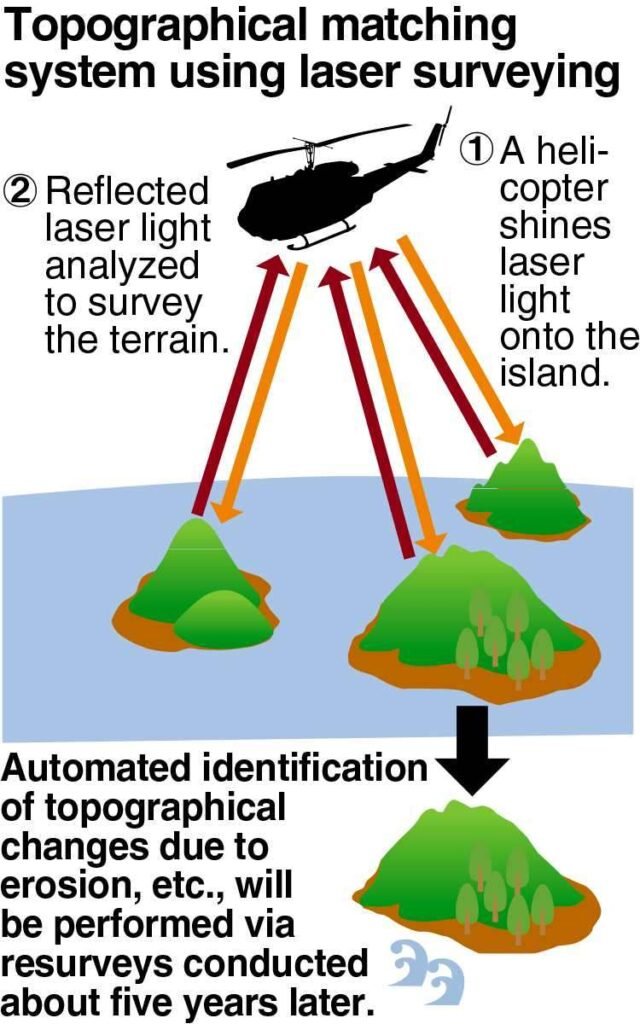
The government will use laser-based surveys in the current fiscal year and aim to create a “topographical matching system” by 2026. This system will help compare changes in the land more easily and automatically.
This project will help quickly identify problems like erosion and other changes, which are important for maintaining Japan’s territorial waters and its exclusive economic zone (EEZ).
The Cabinet Office and the Geospatial Information Authority of Japan will work together to collect data on all 473 of Japan’s remote border islands by 2028. They will use aerial photos and lasers for this survey.
Border islands are important for Japan’s territorial waters and EEZ. Territorial waters extend about 22 kilometers from the coast, while the EEZ extends up to 370 kilometers.
Previously, surveys compared aerial photos and satellite images taken every 10 years and used on-site checks to measure changes. Now, aerial photography will occur every five years, and more intensive laser surveys will be conducted on 25 islands that are highly susceptible to erosion.
Laser surveys involve shining light from a helicopter on the island, and then the terrain shape is measured by examining the reflected light.
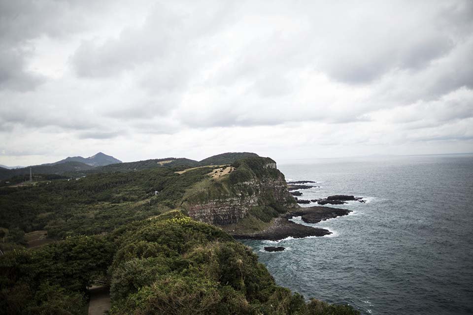
Islands like Kita-Kojima, Naka-Kojima, and Minami-Kojima, located in the East China Sea, will be included in the survey. These islands are important because they have good fishing areas.
The new system will collect data from photos and laser surveys, then automatically compare it with data from future surveys every five years. This will help track changes and erosion.
By detecting changes early, the government can start conservation work on time. For example, they built a seawall at Okinotorishima Island to prevent erosion.
Since these islands are far from the mainland, it takes time to assess their condition. The government is increasing its surveys because some islands have already disappeared.
Esanbe-Hanakita-Kojima Island, off Hokkaido, sank in 2018 due to erosion from waves and ice. In 2023, the government decided the island was no longer considered an island.
In 2023, the government found that Japan now has 473 border islands, down from 484. This change happened because 14 islands were lost and 3 new ones were added.
The Cabinet Office said that losing these islands would shrink Japan’s territorial waters and EEZ, which could affect Japan’s fishing areas and seabed resources.
For more news visit questiqa.com